May 29th, 2022
Somewhere in Nicaragua
Happy Gloomy Sunday Funday! Winter is here and the rainy season this year, I think is gonna be a wet one! Aside from making it harder for me to take pics. The rain is one of the best things for this country. It gives a mass majority of the people here water for, drinking, food (their crops), helps keep all dust down which is really bad especially way out here in no-mans land and the fincas, where all the roads are mostly rock and dirt. So as long as the winds don’t go backwards, mother nature can bring us as much rain as she wants! You’re gonna be wet anyways out there surfing so might as well enjoy it either way!


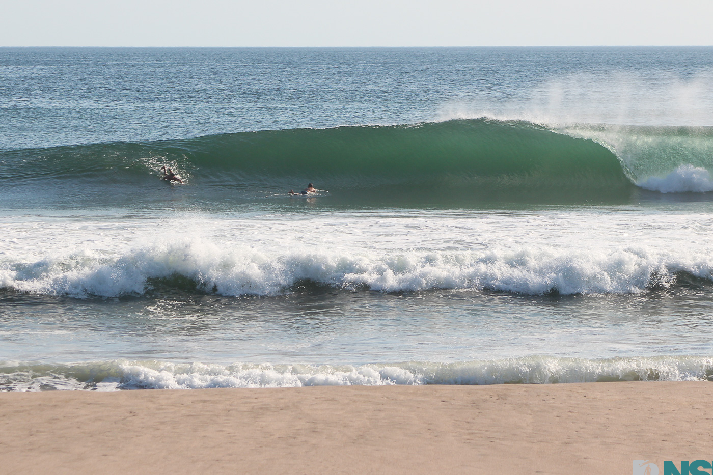
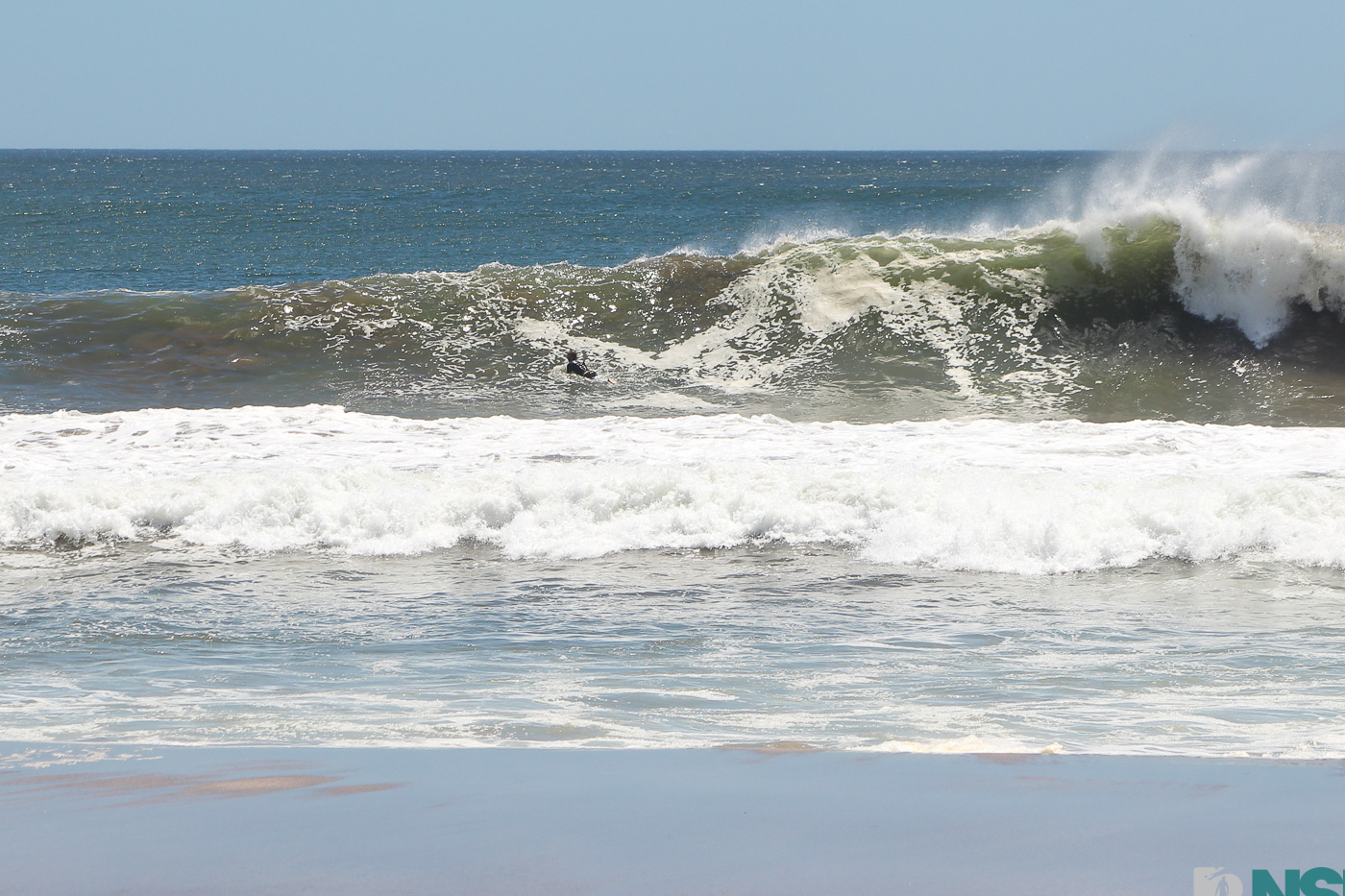
Still offshore, but this hideaway surfer didn’t wanna come out of the barrel and stayed in there as long as he could!

Mike using every inch of his 6’3” body to contribute to the precipitation. Haha!

Still some solid nuggets. A bit less consistent than the pas t few days, but glassy and light offshore is a beautiful thing! (remember he’s well over six feet. So that’s a good size wave!

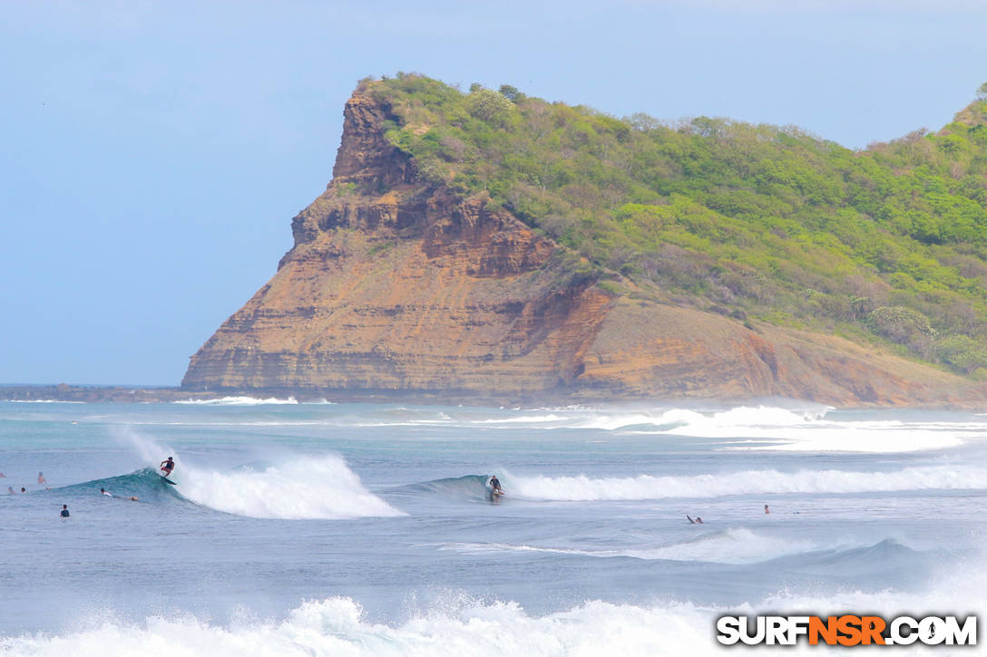
Mikey on his “Forest Green” custom made “Sharp Eye”…. jajaja totally inside joke. But hey dude, I like the Ferrari Green!

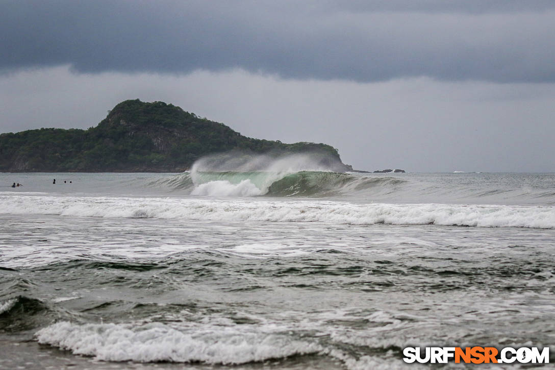
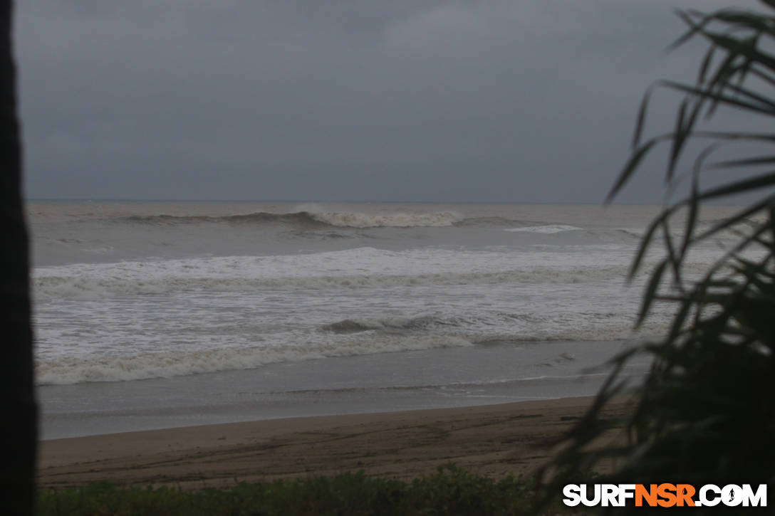
The rain storm that’s been brewing finally made landfall when I started to do the writing pat of my report today. It’s onshore and not so bueno now, but still looking pretty good before though!

Clean and groomed and empty. 3 things that are synonymously every surfers dream spot!

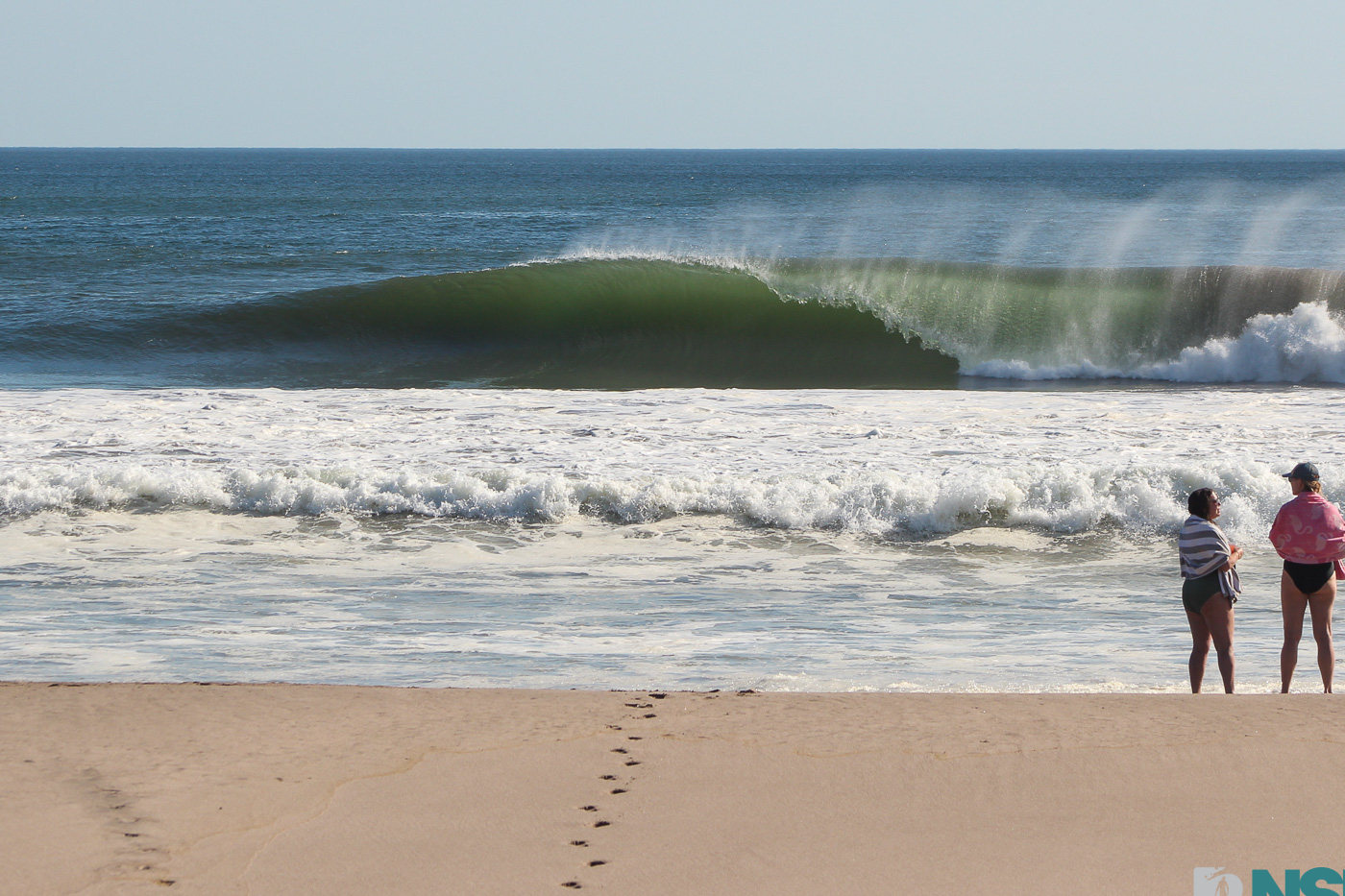
Uh oh! Naaaaa, it’s just a little rain.

OOP, so I got this off a local social media posting earlier. Here’s a good little update on what’s going on up the coast of Nicaragua.************************NOAA NWS National Hurricane Center …FIRST NAMED STORM OF THE EASTERN PACIFIC HURRICANE SEASON FORMS OFF THE SOUTHERN COAST OF MEXICO… …EXPECTED TO BECOME A HURRICANE ON SUNDAY AS IT APPROACHES SOUTHERN MEXICO… A Hurricane Watch is in effect for the southern coast of Mexico from Salina Cruz to Punta Maldonado. Hurricane conditions are possible within that area on Monday, with tropical storm conditions possible late Sunday or early Monday. Interests elsewhere in southern Mexico should closely monitor the progress of Agatha. Additional watches and warnings will likely be required for portions of this area later today. At 7 a.m. CDT, the center of Tropical Storm Agatha was located over the eastern North Pacific Ocean about 220 miles (355 km) southwest of Puerto Angel, Mexico. Agatha is moving toward the west near 5 mph (7 km/h). A turn toward the northwest is expected later today, followed by a turn toward the northeast by Sunday. On the forecast track, the center of Agatha will approach the southern coast of Mexico on Sunday and make landfall there on Monday. Maximum sustained winds have increased to near 45 mph (75 km/h) with higher gusts. Tropical-storm-force winds extend outward up to 35 miles (55 km) from the center. The estimated minimum central pressure is 1002 mb (29.59 inches). Additional steady to rapid strengthening is forecast to occur, and Agatha is expected to become a hurricane on Sunday. Storm surge could produce coastal flooding near and to the east of where the center passes the coast in areas of onshore winds. The surge may be accompanied by large and destructive waves. Agatha will produce heavy rains over portions of southern Mexico by Sunday into Tuesday night. The following rainfall amounts are currently expected: – Mexican state of Oaxaca: 10 to 16 inches, with isolated maximum amounts of 20 inches possible. Life-threatening flash flooding and mudslides may occur. – Mexican states of Chiapas and the eastern portions of Guerrero: 5 to 10 inches, with isolated maximum amounts of 15 inches possible. Life-threatening flash flooding and mudslides may occur. – Mexican states of Vera Cruz and Tabasco: 2 to 4 inches, with isolated maximum amounts of 6 inches possible. The next complete advisory will be issued by NHC at 10 a.m. CDT – www.nhc.noaa.gov/#Agatha

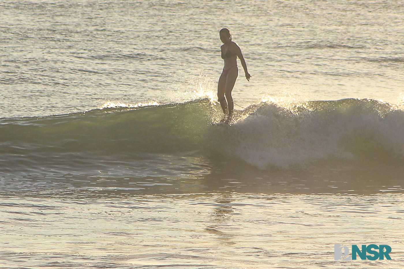
When your surfboard says it’s time to go in but the surfer refuses. Hahahaaa

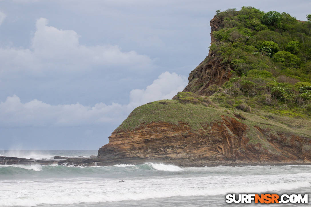
Los Perros all lit up, with some nice sunlight that peeked out and that beautiful lush greenery that’s only gonna grow that hillside into one giant Chia Pet Cliff! LOL – if you can’t make some fun out of your work, then you’re in need of a vacation! Enjoy the rest of your weekend and let’s see what the weather brings us mañana ~
RECENT REPORTS
Hey everyone! Welcome to Tuesday afternoon’s surf report from Colorados. It was likely the last day of large-ish surf for a while. It took patience and good positioning, but there were some great barrels made today.
Hey amigos! Welcome to Monday’s plus-size swell report from Colorados. There were some good windows throughout the day, but you still needed to be patient and in the right place at the right time. Some epic ones to be found though.
Hey everyone! Welcome to Sunday’s report from Colorados. The swell definitely showed up in force and was even bigger at sunset. A lot of water and sand moving around out there. Check out the size of this wave relative to the surfer going over it.
FROM THE ARCHIVES
Super fun waves this morning on the mid to low tide window, got down to the beach around 8:30am and shot for about an hour.. lots of tubes fun sized coming through and some corners and longer peelers too so a nice variety of waves to choose from this AM. It’s looking like another heavenly..
Happy Friday people! We all woke up to a nice big new swell this morning. Unfortunately the wind and weather had some other ideas for making today for surf so we did what’s best… we improvised and looked for the best place around that was working… well, semi working. Take a look!
Good afternoon ladies and gents! Parker here logging on today to bring you some shots from the morning. We have some goodies for y’all so click “read more!”